Cable Detector

New products

New products
    • CHC Alpha 3D
      • New
      home
      CHC Alpha 3D
      Alpha 3D is an advanced mobile mapping solution for 3D mass data acquisition.
      SAR0.00 Price
      CHC HCE600 Data Collector
      • New
      home
      CHC HCE600 Data Collector
      The HCE600 is a lightweight, compact, professional Android 10 data collector with an alphanumeric keypad, specifically designed for surveying and...
      SAR0.00 Price
      CHC HCE320 Data Collector
      • New
      home
      CHC HCE320 Data Collector
      HCE320 is a professional rugged android data collector for any demanding surveying and construction applications.
      SAR0.00 Price
    • CHC iBase & i73 Rover
      • New
      home
      CHC iBase & i73 Rover
      The ultimate GPS system, it offers best-in-class GNSS signal tracking even in a harsh environment, enabling GNSS surveying beyond usual constraints.
      SAR0.00 Price
      CHC iBase GNSS
      • New
      home
      CHC iBase GNSS
      The iBase GNSS receiver is a fully integrated professional GNSS base station, specifically designed to meet 95% of surveyors' needs when working in...
      SAR0.00 Price
      CHC i73 (Rover only)
      • New
      home
      CHC i73 (Rover only)
      i73 Featuring full GNSS technology, it offers best-in-class GNSS signal tracking even in a harsh environment, enabling GNSS surveying beyond usual...
      SAR0.00 Price
All new products
CHC Alpha 3D
  • New
  • CHC Alpha 3D
  • CHC Alpha 3D
  • CHC Alpha 3D

CHC Alpha 3D

SAR0.00
Tax included

Alpha 3D is an advanced mobile mapping solution for 3D mass data acquisition.

Quantity
Backorder, ships with in 4 weeks

PREMIUM HIGH PERFORMANCE LASER SCANNER

Long range scanning up to 475 m

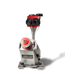
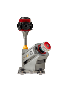
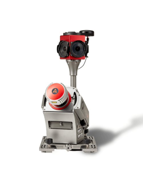
Provide high-speed scanning of 1.8 million points per second, high point cloud density even at fast driving speed and extreme quality point cloud with low range noise.

HIGH RESOLUTION 360° IMAGES

30 MP HDR panoramic camera with superb image quality

Support fully calibrated point clouds and panorama images. You can add additional imagery sensors to get extra information whenever your application needs.

READY NOW TO ANTICIPATE FUTURE

Ready to add 2nd scanner for more density point clouds

Provide two RS232 ports for external device connection, 2nd GNSS antenna to work on railway or water applications, and an easy-in easy-out SSD hard disc for faster data transfer.

VEHICLE INDEPENDENT PLATFORM

Easily mounted on different type of vehicles, trains, railway trolleys and boats

Whatever the task is, the Alpha3D rapidly and efficiently collects high density, accurate point clouds and powerful images data, but also adds extra information from additional sensors, such as high-resolution camera, thermal camera, GPR, echo-sounder or extra profiler.

3D POINT CLOUD PROCESSING SOFTWARE

Powerful and accurate 3D point cloud generation

CoPre is an advanced, user-friendly 3D laser scanning pre-processing software that can process captured raw data, including POS trajectories, LiDAR data, and RGB images. CoProcess is a reality capture post-processing software providing DEM/DTM generation, semi-automated feature extraction, automatic data classification, and dedicated power line and road inspection modules.  With its intuitive interface and efficient workflow, the software significantly improves the productivity of 3D mapping projects.

For specifications, please check the details tab or download the brochure from the attachments tab
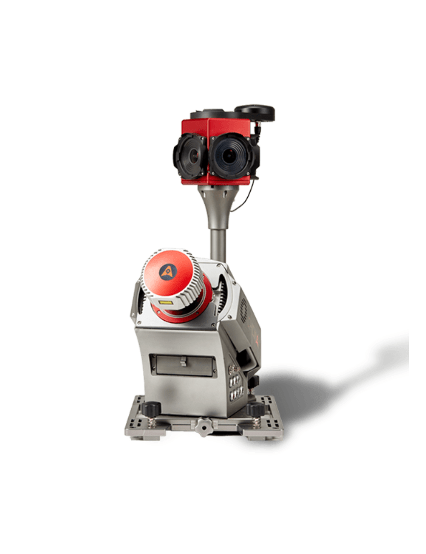
CHC-SV-0008